Depth Queries
Tap anywhere on the map to get the exact depth at that location.
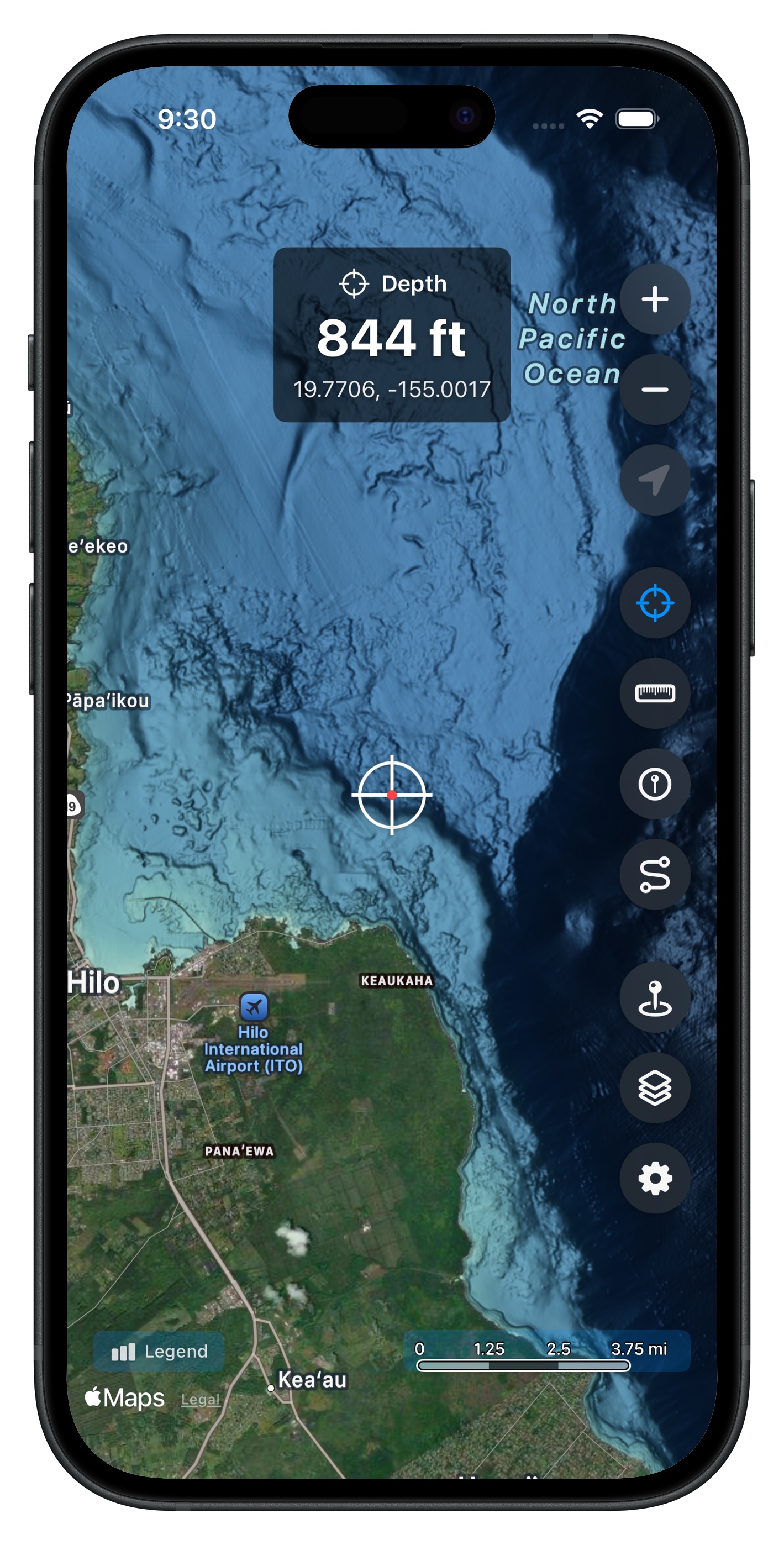
Precision Depth Data
Position the crosshairs anywhere on the map to instantly see the ocean depth at that point. Data comes from NOAA's 3-meter resolution CUDEM dataset, giving you accuracy down to the tenth of a meter.
How It Works
The depth display updates in real time as you pan the map. The crosshairs at the center of the screen continuously query the underlying bathymetry data, showing depth in your preferred unit -- feet, meters, or fathoms.
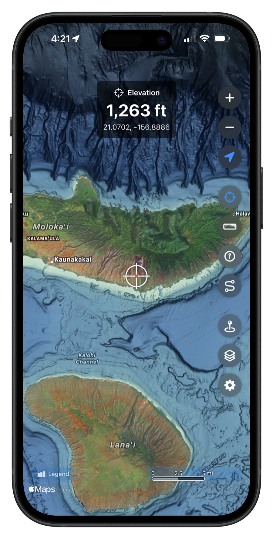
Land Elevation
The depth query works on land too. Pan over any island to see the elevation above sea level, displayed in the same overlay. Great for understanding the full topography from mountaintop to ocean floor.
Flexible Units
Choose your preferred depth unit in Settings:
- Feet -- most common for recreational fishing
- Meters -- standard for scientific and international use
- Fathoms -- traditional nautical measurement
Get Hawaii Ocean Map
$9.99 one-time purchase. No subscriptions, no ads.