Fishing Zones
Know the rules before you cast. 86 DLNR fishing restriction zones on the map.
Official DLNR Data
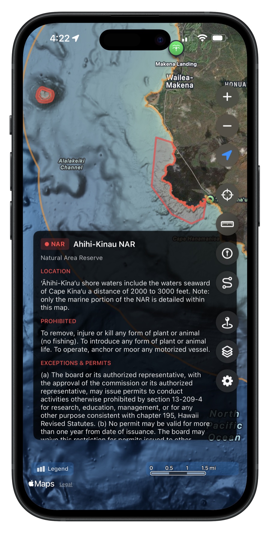
The app displays 86 official fishing restriction zones from the Hawaii Department of Land and Natural Resources (DLNR) Division of Aquatic Resources. These boundaries are shown directly on the map with color-coded overlays so you can see exactly where regulations apply.
Zone Types
Each zone type has a distinct color so you can quickly identify what kind of restriction area you're looking at:
- Marine Life Conservation Districts (MLCDs)
- Fisheries Management Areas (FMAs)
- Fish Replenishment Areas (FRAs)
- Natural Area Reserves
- Bottomfish Restricted Fishing Areas
- And more
Tap for Details
Tap any zone on the map to see its name, type, and a summary of specific restrictions. Each zone links to the official DLNR regulations page so you can read the full rules before heading out.
Toggle and Zoom
Access fishing zones from the Map Layers page. Toggle zones on or off and zoom directly to any zone on the map. Zones are always available offline -- no download required.
Get Hawaii Ocean Map
$9.99 one-time purchase. No subscriptions, no ads.