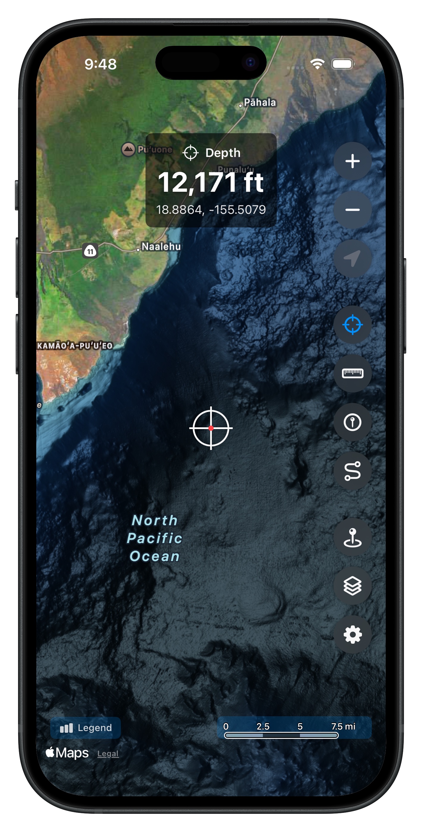
High-Resolution Bathymetry
See the seafloor in stunning detail with 3-meter resolution data.
Professional-Grade Data
Hawaii Ocean Map uses NOAA's Continuously Updated Digital Elevation Model (CUDEM) at 3-meter resolution -- the highest quality publicly available bathymetry data for Hawaiian waters. This is the same data used by professional marine researchers and NOAA itself.
Complete Coverage
Every Hawaiian island is covered with high-resolution seafloor mapping, including:
- Oahu, Maui, Big Island, Kauai
- Molokai, Lanai, Niihau, Kahoolawe
- Nearshore reefs, drop-offs, and deep ocean structures
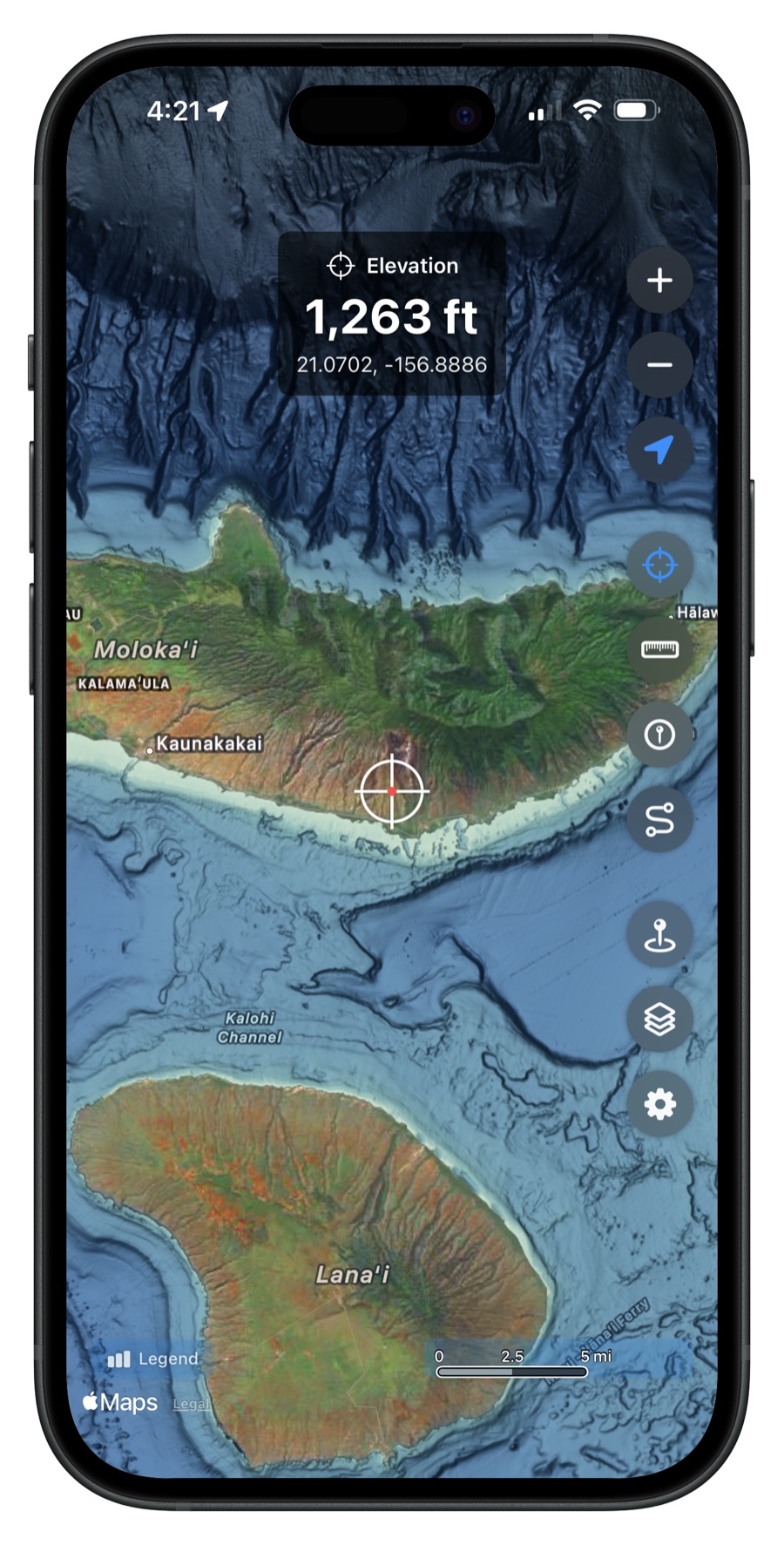
Land Elevation Too
The map doesn't stop at the shoreline. View land elevation data across all islands, useful for understanding the full terrain from mountaintop to ocean floor.
Color-Coded Depth Visualization
Depths are displayed with an intuitive color gradient -- lighter blues for shallow water, darker blues and purples for deep ocean. Quickly identify ledges, drop-offs, reefs, and underwater structures at a glance.
Get Hawaii Ocean Map
$9.99 one-time purchase. No subscriptions, no ads.