ORMA Zones
188 ocean recreation management areas across 6 islands. Know the rules for your waters.
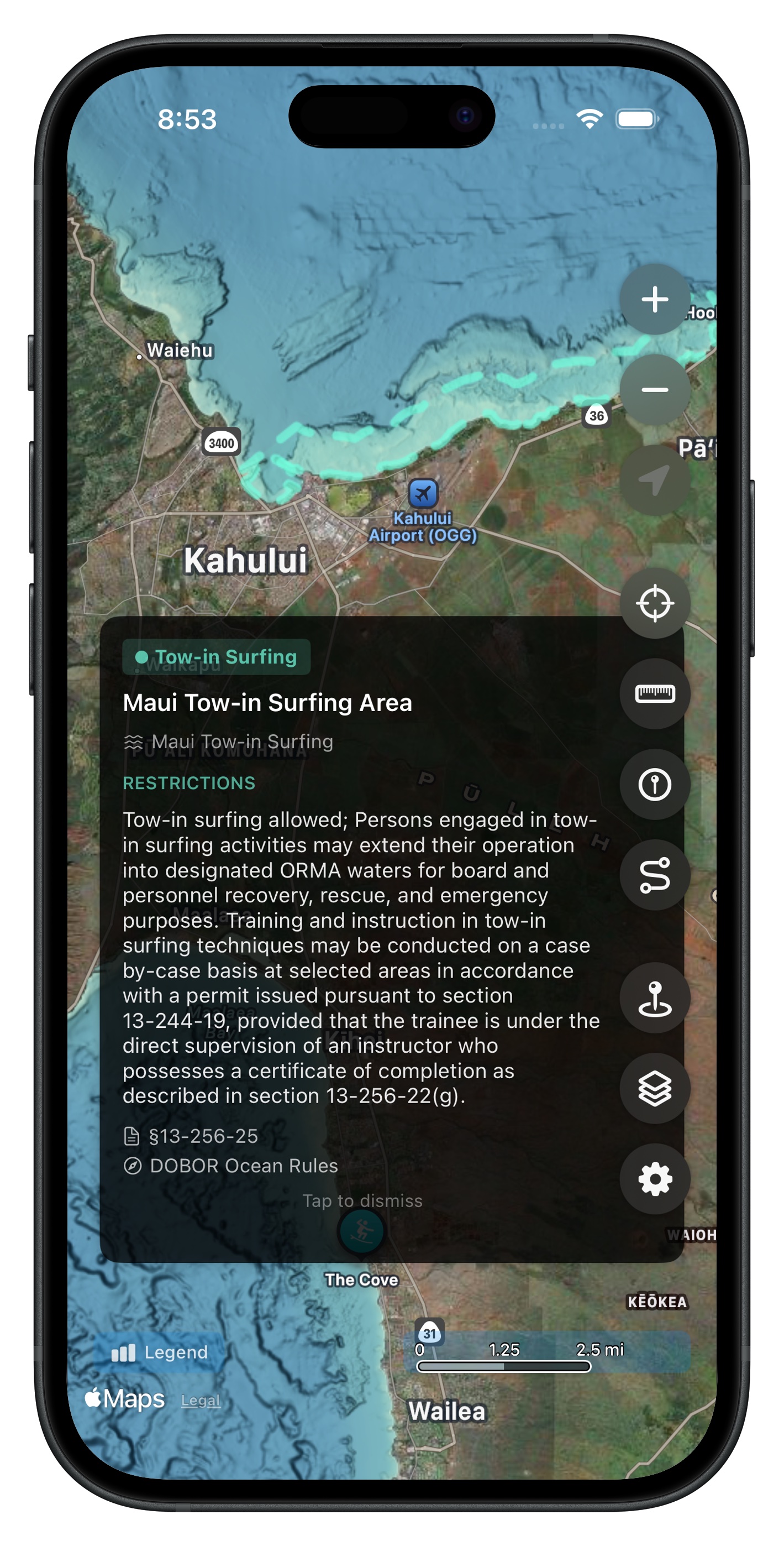
Official DLNR DOBOR Data
The app displays 188 ocean recreation management area polygons sourced from the Hawaii DLNR Division of Boating and Ocean Recreation (DOBOR). These zones regulate activities like surfing, swimming, vessel operations, thrill craft use, and more.
Color-Coded by Activity
Each zone type has its own color and line style matching official DLNR symbology, so you can quickly identify what kind of area you're in:
- Ocean Waters Regulated Activities
- Swimming and Diving Activities
- Recreational and Commercial Thrill Craft
- Vessel and Speed Restricted areas
- Surfing and Windsurfing Activities
- Parasailing, Outrigger Canoe, and more
27 Groups Across 6 Islands
Zones are organized into 27 toggleable groups so you can show just the areas you care about. Coverage includes O'ahu (93 zones), Kaua'i (34 zones), Big Island (32 zones), Maui (26 zones), Lana'i (2 zones), and a statewide thrill craft prohibited area.
Tap for Details
Tap any zone on the map to see its name, designation type, and the group it belongs to. Zones are always available offline -- no download required.
Get Hawaii Ocean Map
$9.99 one-time purchase. No subscriptions, no ads.