High-Resolution Ocean Maps for Hawaiian Waters
Built specifically for Hawaiian fishermen, divers, boaters, and ocean enthusiasts who need accurate depth charts and seafloor topography. Access the highest-quality bathymetry data available.
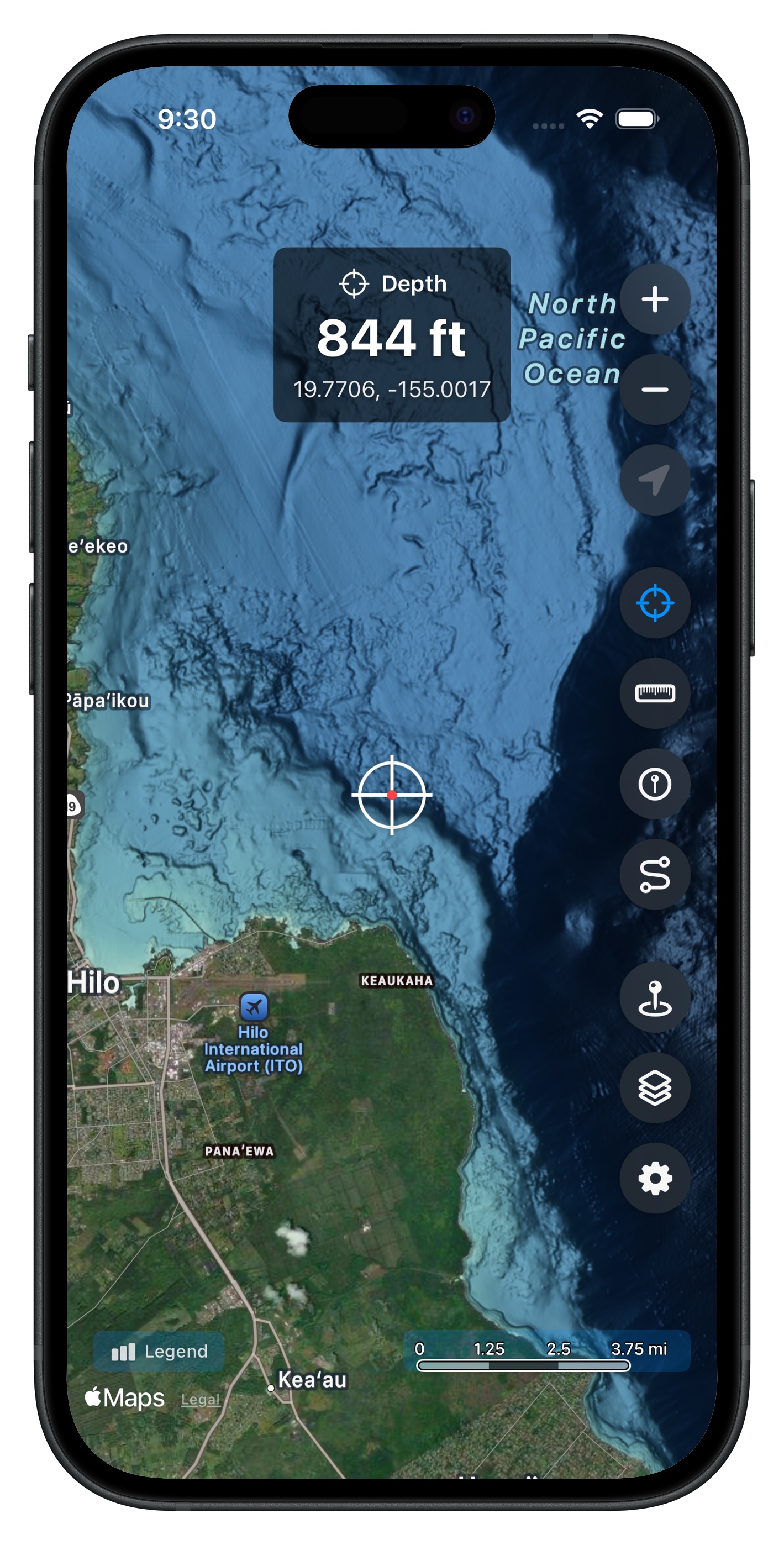
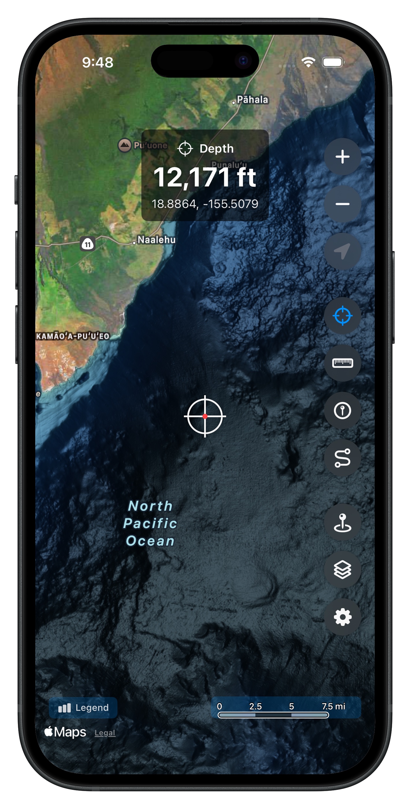
Query depth anywhere on the map
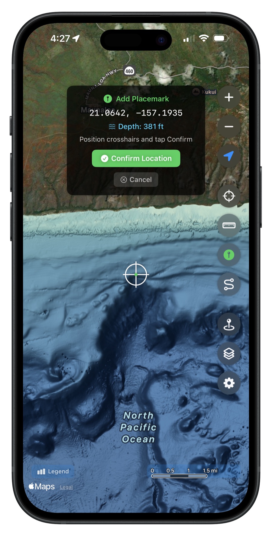
Save placemarks with depth info
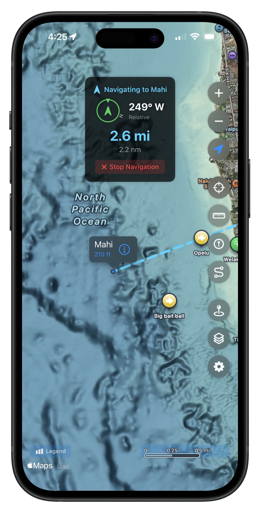
Navigate to saved waypoints
Explore detailed bathymetry maps
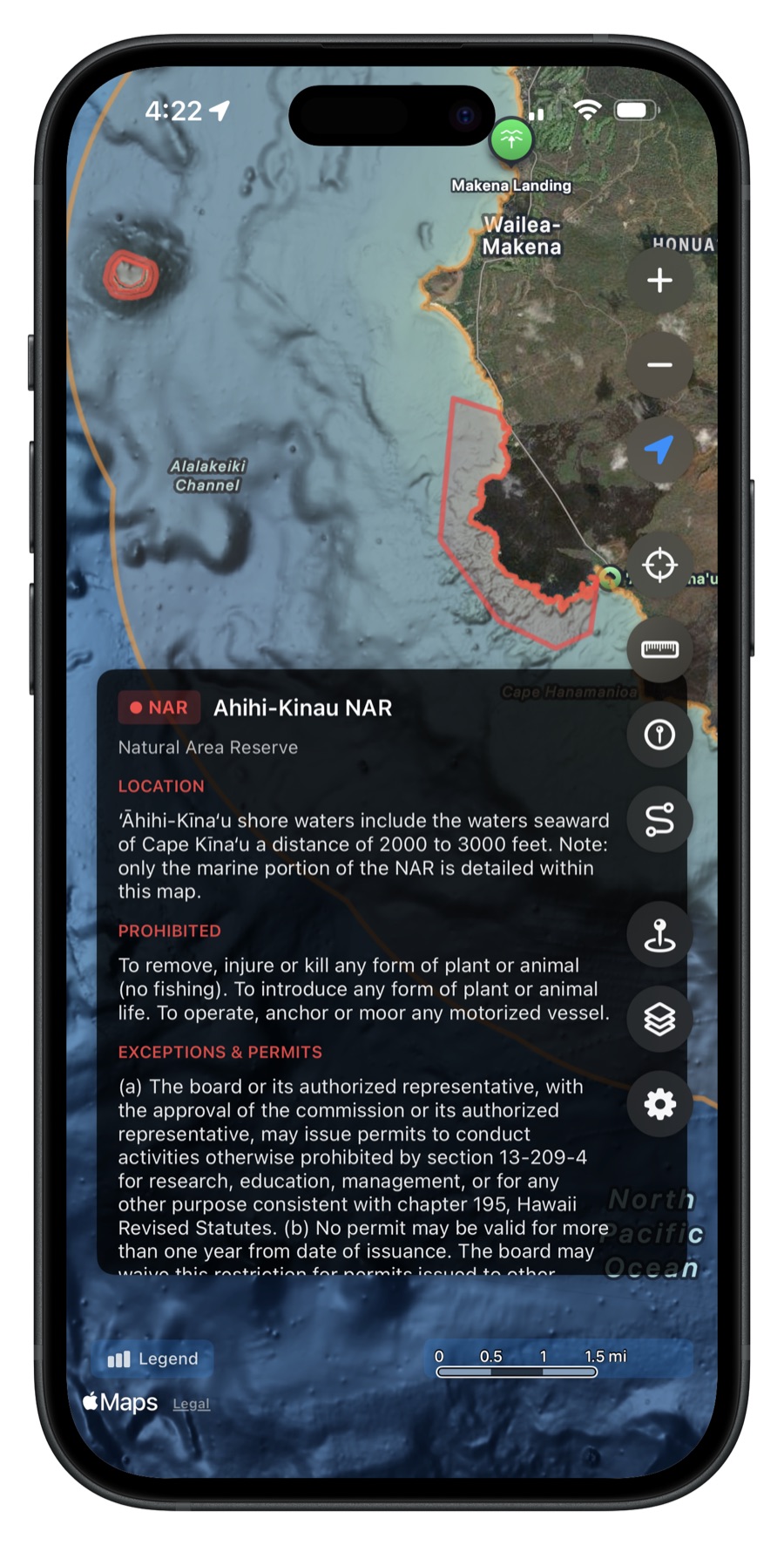
View fishing restriction zones
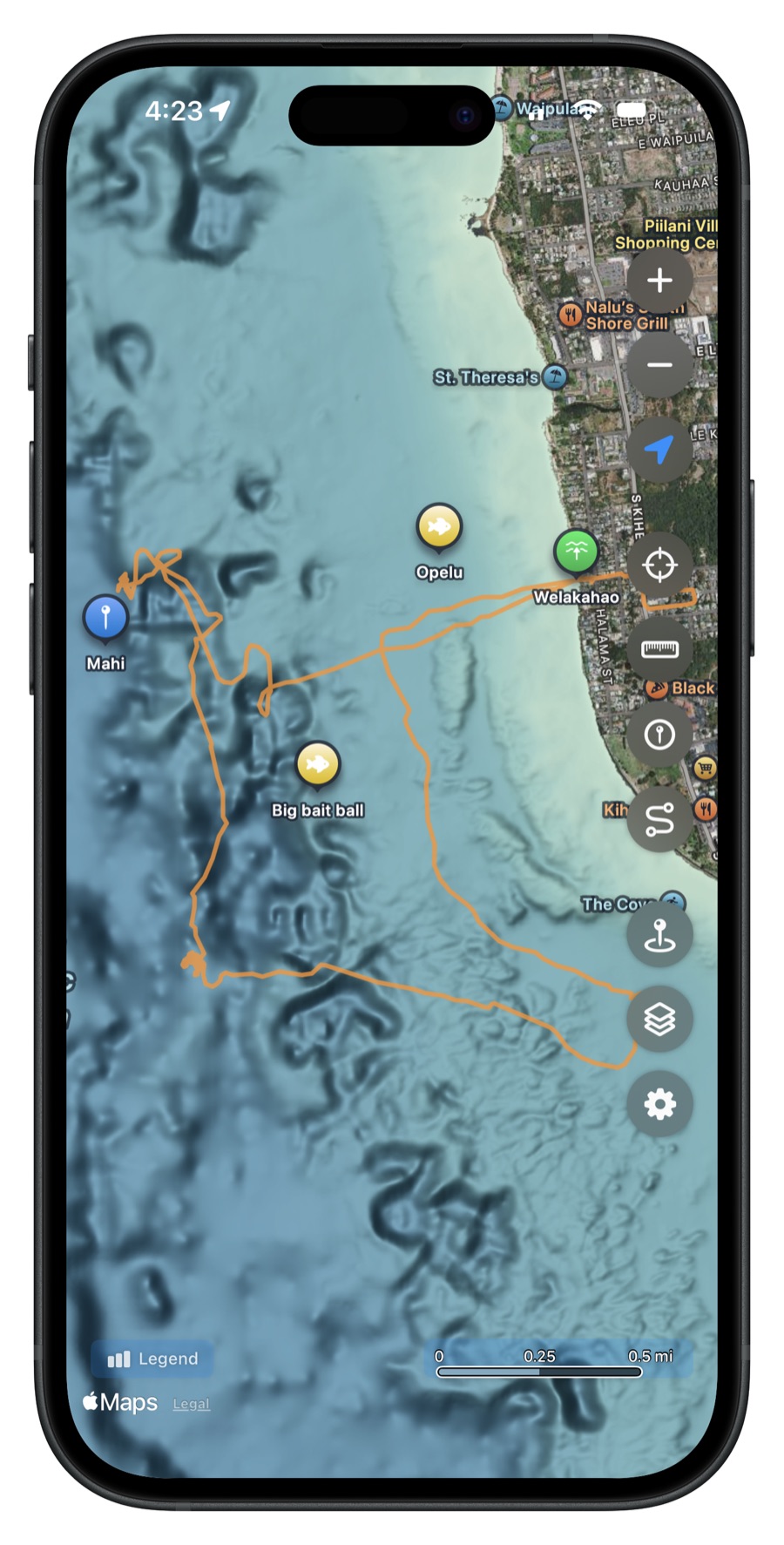
Record GPS tracks
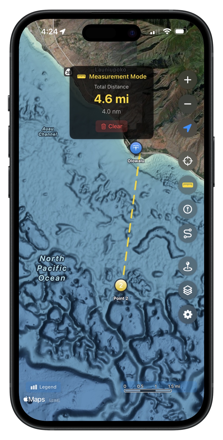
Measure distances between points
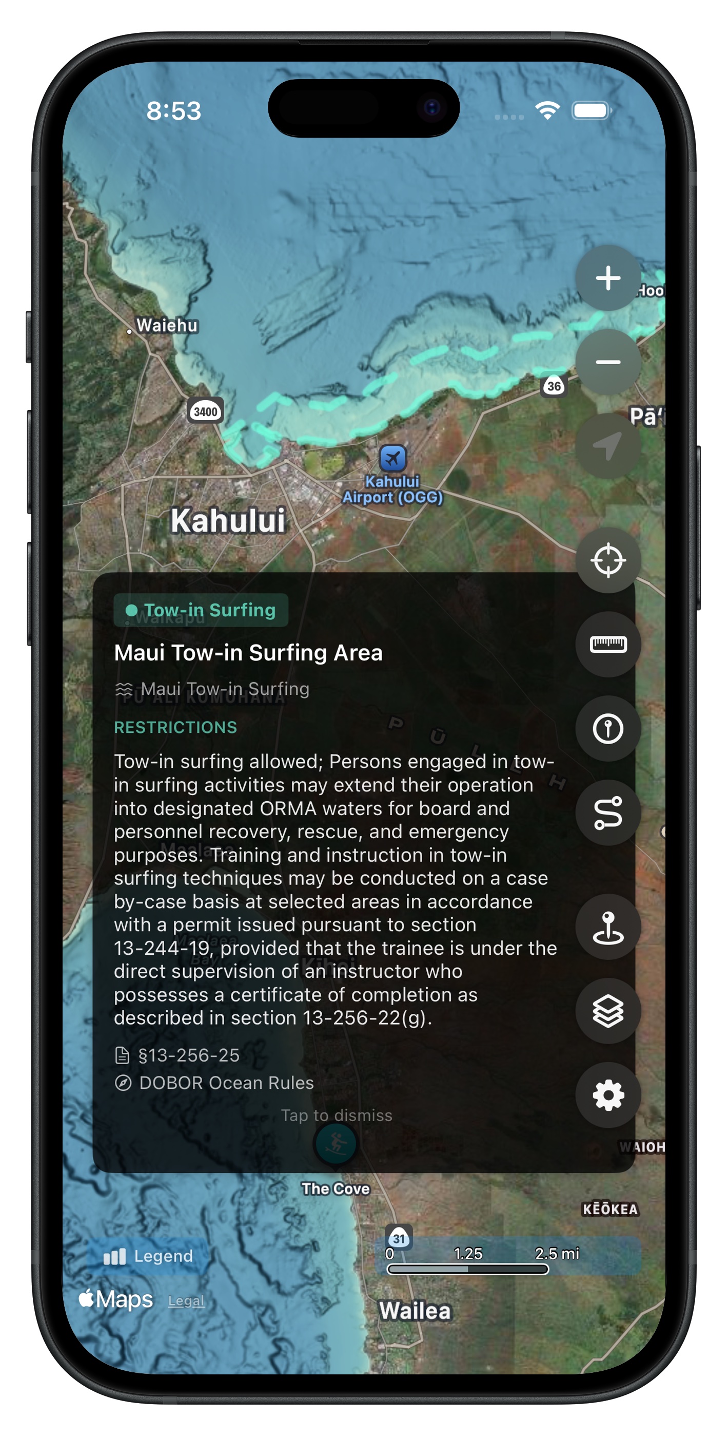
Browse ORMA ocean recreation zones
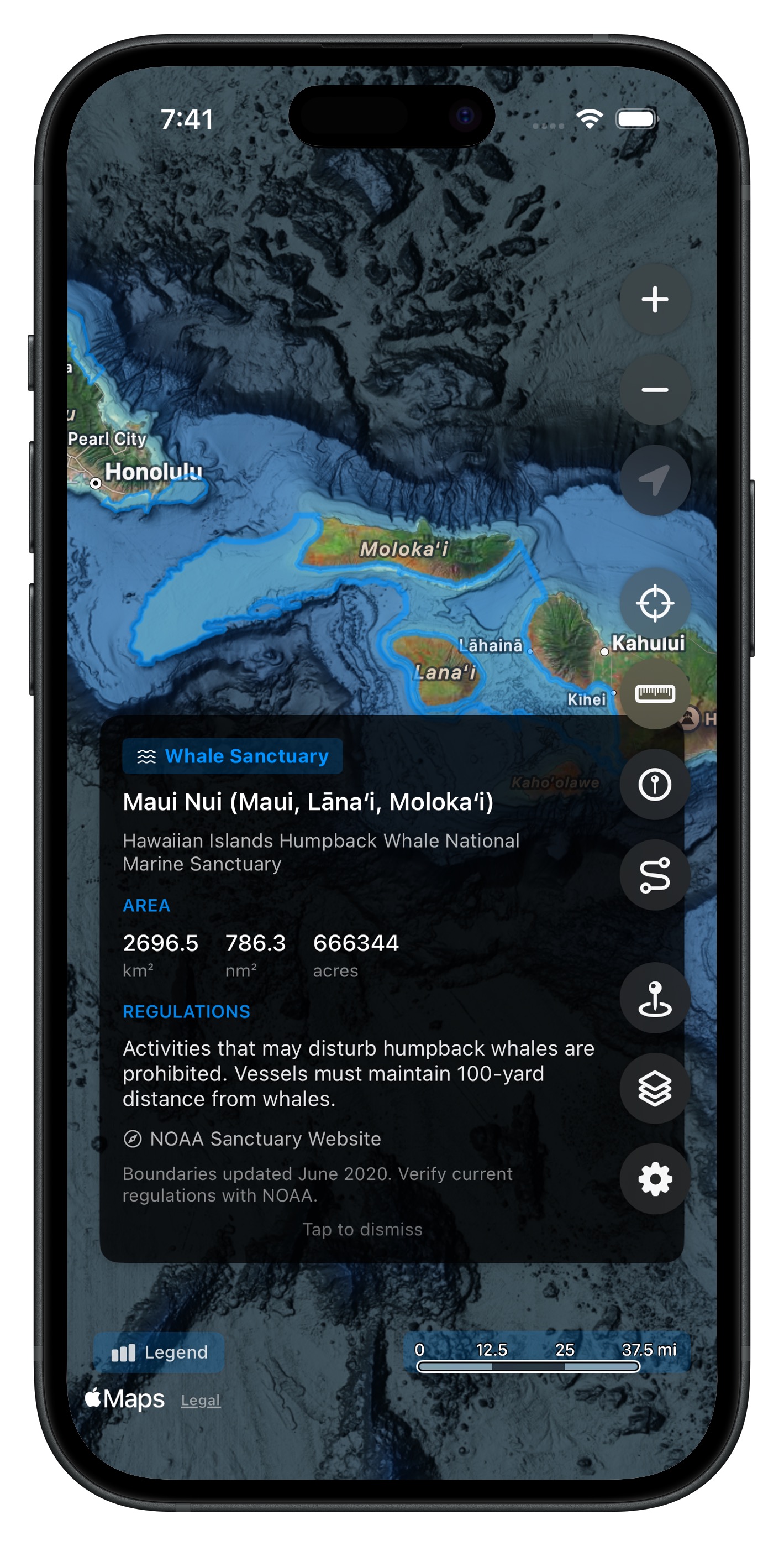
View whale sanctuary boundaries
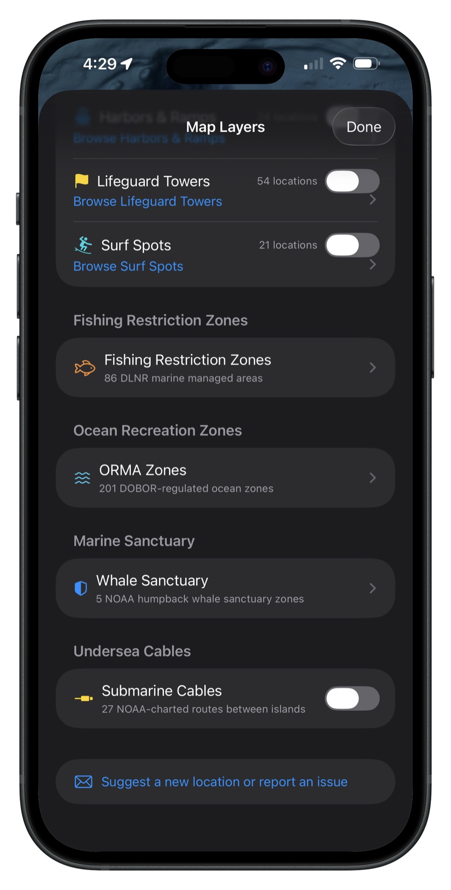
Toggle and explore map layers
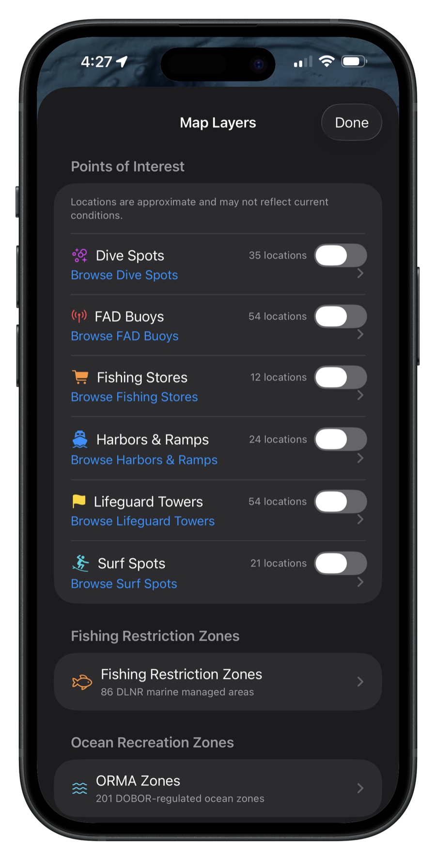
Browse points of interest
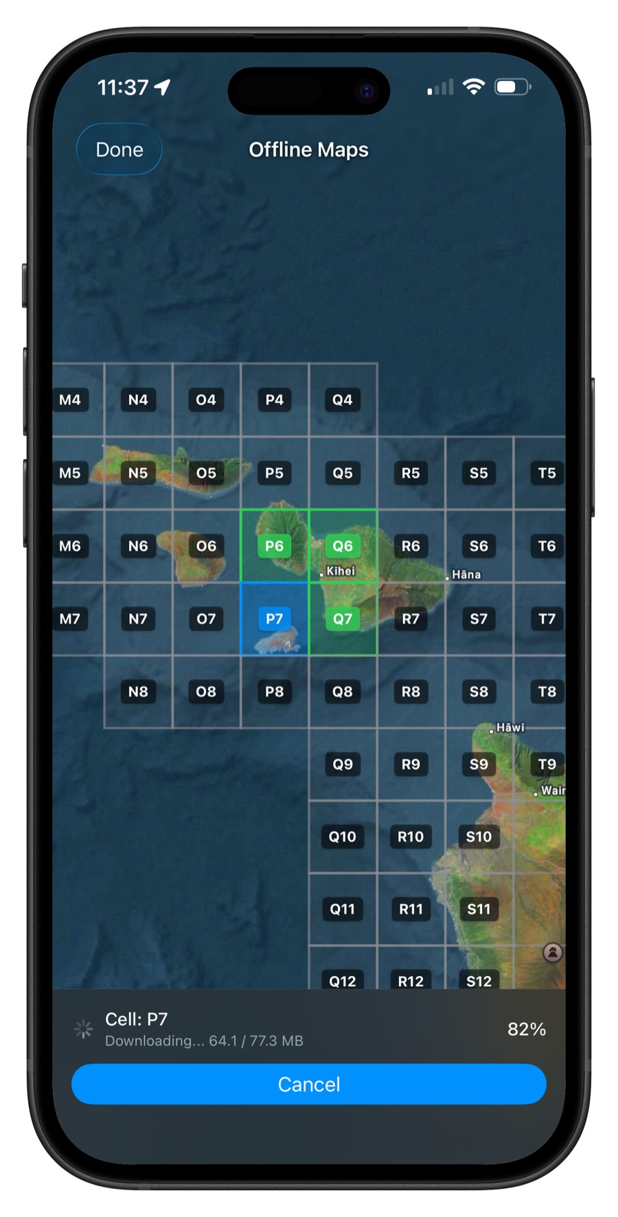
Download maps for offline use
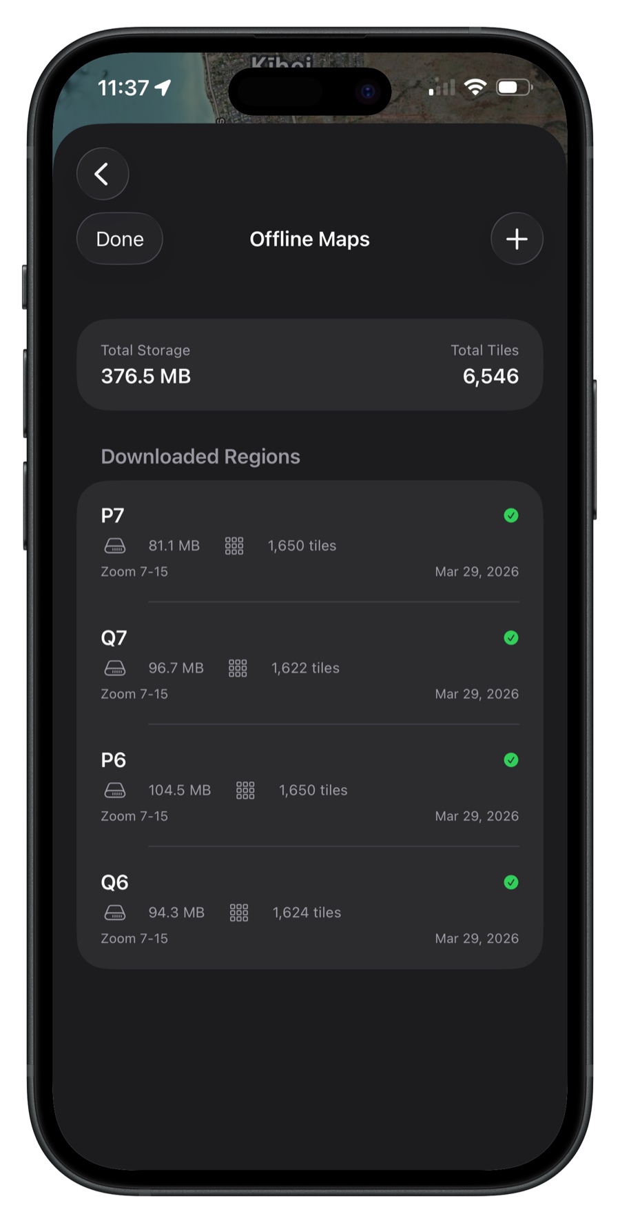
Manage downloaded regions
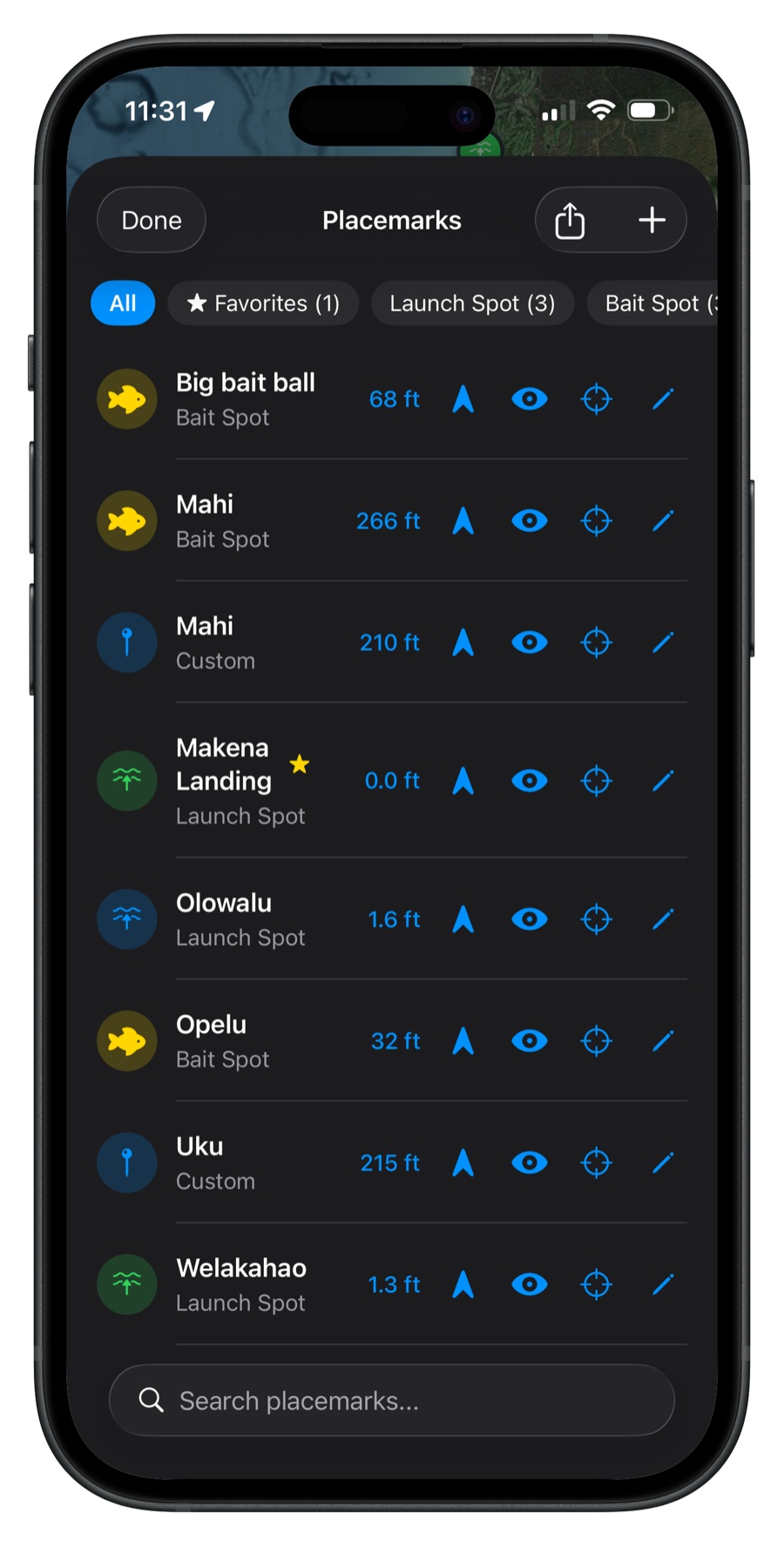
Organize your saved locations
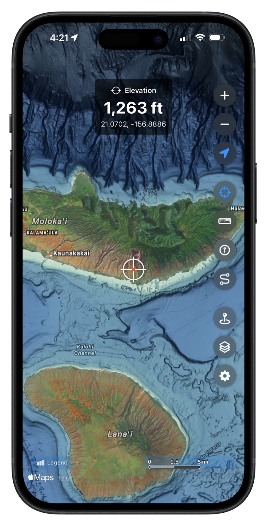
View land elevation data
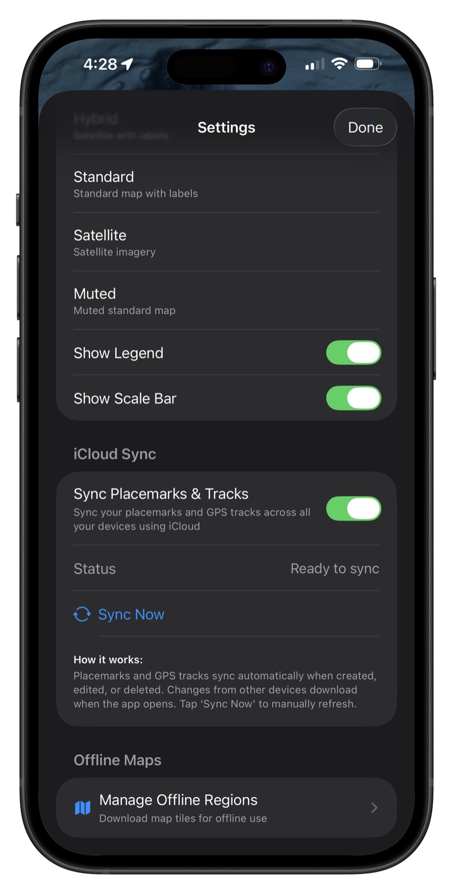
Customize settings and sync across devices
Available on iOS and Android

Features
High Res
3-meter NOAA CUDEM data provides amazing detail of the seafloor around all Hawaiian Islands.
Offline Maps
Download maps for offline use. Perfect for when you're out on the water with limited connectivity.
Depth Queries
Tap anywhere on the map to query exact depth at any location with precision accuracy.
Placemarks
Save, sync, and organize your favorite fishing spots, dive locations, and points of interest.
Navigate to Waypoints
Select any saved placemark and get live bearing, distance, and a compass guiding you to your destination.
Measurements
Measure distances between points in nautical miles, kilometers, or statute miles.
GPS Tracks
Record your routes with GPS tracking. Export as GPX files and sync across devices with iCloud.

Map Layers
All ocean overlays in one place. Toggle and zoom to fishing zones, ORMA areas, whale sanctuary, submarine cables, and points of interest.

Fishing Zones
86 official DLNR fishing restriction zones with color-coded overlays. Tap any zone for details and regulations.

ORMA Zones
188 ocean recreation management areas across 6 islands from DLNR. Know the rules for your waters.

Whale Sanctuary
Humpback whale sanctuary boundaries covering 5 protected zones around the Hawaiian Islands.

Points of Interest
Browse harbors, boat ramps, FAD buoys, surf spots, dive spots, lifeguard towers, and fishing stores across all islands.
Frequently Asked Questions
Yes! Download maps for your fishing areas while you have WiFi, then use them offshore with no internet connection. Map layers, placemarks, and GPS tracks always work offline with no download required — only the bathymetry map tiles need to be downloaded ahead of time. Perfect for when you're miles from shore.
All Hawaiian Islands are covered with high-resolution 3-meter NOAA CUDEM data, including Oahu, Maui, Big Island, Kauai, Molokai, Lanai, and Niihau.
$9.99 one-time purchase. No subscriptions, no ads, no in-app purchases. Pay once and own it forever.
We use NOAA's Continuously Updated Digital Elevation Model (CUDEM), the highest-quality publicly available bathymetry data for Hawaiian waters. This is the same data used by professional marine researchers and NOAA itself.
Hawaii Ocean Map is available on iPhone, iPad (iOS 17.0+), and Android devices (Android 8.0+). Optimized for all screen sizes.
The app includes a dedicated Map Layers page where you can toggle and explore ocean overlays. Layers include 86 official fishing restriction zones from Hawaii DLNR, 188 ORMA ocean recreation management areas, humpback whale sanctuary boundaries, submarine cable routes, and curated points of interest (harbors, boat ramps, FAD buoys, surf spots, dive spots, and lifeguard towers). Tap any layer to zoom to it on the map.
On iOS, your placemarks are stored on your device and in your personal iCloud account — no one else, including me, can access them. On Android, placemarks are stored on your device with optional cloud sync via Firebase, which does not offer the same level of privacy as iCloud (the app developer has access to the Firebase database). I will never share, sell, or make your data public. See the Privacy Policy for full details on how your data is stored and protected.
Map tiles and offline regions will need to be re-downloaded after reinstalling, but your placemarks and GPS tracks will automatically sync back. On iOS, your data restores when you sign in with the same Apple ID and also syncs across all your Apple devices. On Android, your data restores when you sign in with the same Google account and syncs across your Android devices.
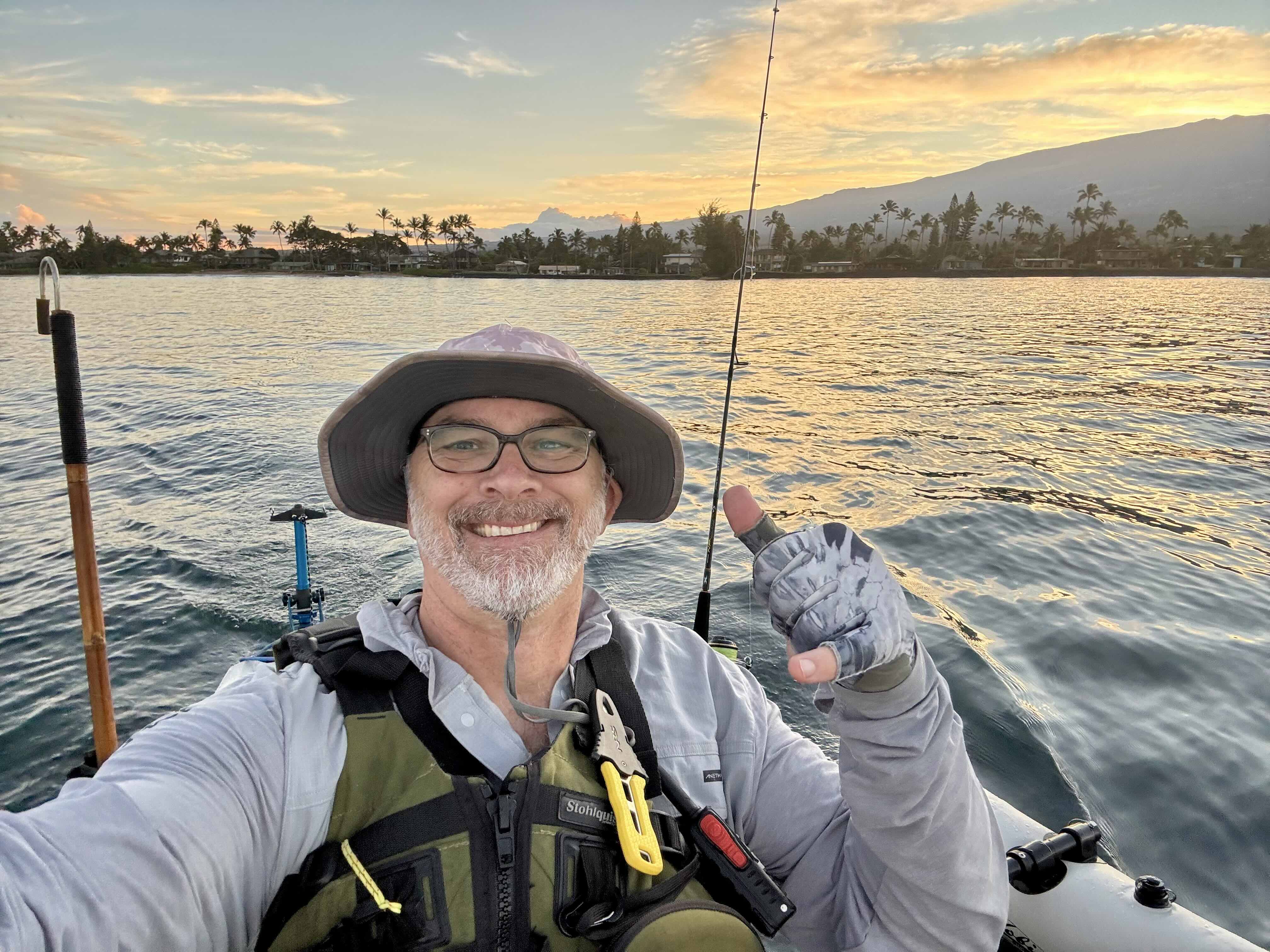
Built by Jorma.com, an ocean lover who also likes to build maps.